
One of my first blog posts was back in spring 2016, at what seems a much more innocent point in time. It’s probably just as well that we did not know then about what was lined up in front of us: the nasty triumvirate of Brexit, Trump and Covid-19 that would dominate the last five years, and which still keeps on giving . . .
*
With the rapid development of the surrounding area in the first half of the 19th century, Kennington Common lost its ancient agricultural purpose and became a mere dumping ground for rubbish. In 1849 an observer stated that “The stunted herbage is trodden and soiled by a troop of cows belonging to a neighbouring milkman. A kind of pond near one corner, and a deep ditch opposite South Place, are the cemeteries of all the dead puppies and kittens of the vicinity.” The vitriol factory on the east side gave off a constant stream of sulphurous vapour, and the ditches presented “an accumulation of black offensive muddy liquid, receiving constant contributions from numerous unmentionable conveniences attached to a line of low cottage erections”.
Survey of London: Vol 26, Lambeth, F H W Sheppard (ed): 1956
A manufactory for oil of vitriol, on the east side of Kennington Common, occupies three acres of ground; and between that and the Kent-road are, a smelting-house for lead and antimony, a tannery, a manufactory for glue, another for tobacco-pipes, with manufactories for floorcloth and for carriages.
A Topographical Dictionary of England: Newington, S Lewis (ed): 1848
In 1852, the Kennington Common Enclosure Act led to a revoke of the rights of the local population to use the common land of the Manor of Kennington in the way they had for centuries. Many of the area’s wealthier residents must have sighed in relief. The Common had always had a rather chequered history – it was the site of public hangings in the 18th century and a place where dissenters gathered, as well as an area for local sports and festivities, which could sometimes get out of hand, not to mention the rather dubious activities which went on under cover of darkness.
The famous failed Chartist rally of 1848 – spectacularly captured on daguerreotype by William Edward Kilburn (see below) – had been the final nail in the common’s coffin. Thereafter, efforts moved quickly to consolidate the wishes of local reformers, clergy and politicians to have the land enclosed.

Kennington Common Chartist Rally: 10th April, 1848 (c) The Royal Collection
N.B. The large building in the background of the image is the afore-mentioned Messrs Farmers oil of vitriol manufactory, showing the extent to which it must have dominated the neighbourhood. In this remarkable picture, it seems to resemble a rather menacing symbol of industrialisation looming over those who were demonstrating against the political subjection of the time.
In 1852, six-foot high iron railings were erected around the perimeter of the old common and over a period of two years the badly neglected fields were turned into a public park, which finally opened in March 1854. However, the completed grounds did not at first meet with a particularly welcome reception, and were described by one contemporary as: intersected by un-level, puddle-holding walks, some of them unsightly and crooked, others leading to nothing and nowhere. Other criticisms focused on the lack of evergreens and the unstructured nature of the planting without regard to heights, habits or colours. But from 1858, under the leadership of John Gibson (who’d previously worked as superintendent of the new Battersea Park), the design of the park began to change. Elaborate flower beds were laid out in symmetrical patterns, a style which was at the cutting-edge of mid-Victorian garden design and would soon be adopted elsewhere. For the local residents it was a unique chance to see large areas of flowering plants, and the Gardener’s Chronicle of the time mentions a bordering of flowers as bright as the smoke and vapour from an adjoining vitriol factory will let them be.
When my great-grandfather, Arthur Skelton, and his siblings were growing up at nearby Aldred Rd in the 1860s and 70s (see The Two Arthurs), the park might have been a welcome place for Sunday strolls and games en famille, despite the lack of real freedom for children to play as they pleased. It would certainly have been a vivid contrast to the above-mentioned oil of vitriol factory, spewing out its noxious vapours at the eastern border of the park, and no doubt affecting all those who lived in the neighbourhood – including the residents of 35 Aldred Rd.

In full bloom at Kennington Park, circa 1908
first went to Kennington is search of Aldred Road in the summer of 1991, shortly after returning from two years spent overseas. When starting my genealogical search in the mid-80s (see The Incidental Genealogist is Born) it had somehow never crossed my mind to venture south of the river to seek out the old family haunts. It seems strange to me now that I waited so long to do so. I already had a nascent collection of addresses from the birth, marriage and death certificates I had accumulated, as well as information from the five censuses up to 1881 – as well as more living relatives to question! The only thing which might explain my reticence was this rather strange idea I once had about South London.

Gustave Doré: Over London by Rail, from London: A pilgrimage, 1872
Thinking back to that August afternoon, thirty years ago, two things remain in my mind. Firstly, that I had been completely unaware of just how many elegant Victorian and Georgian buildings graced the streets of south London, hidden behind the layers of dirt and soot. Secondly, that a number of these old buildings seemed to be in the process of either being gentrified or pulled down.
Aldred Road – where Arthur’s family had lived for four censuses in a row – had disappeared off the map (after morphing into Aldred Street somewhere along the line), so I headed along Camberwell New Road to try to find what was left of Cator Street, amazed at the sight of so many architecturally stunning Georgian houses at one stretch. Farther along, I took a short cut through an unexpected open expanse of fields that looked like it too might have originally been part of an old common – although there was something about the place that gave off an eerie feeling of impermanence. Roads that led nowhere. Bridges over dry land. Instinctively I took out my new camera and photographed several old buildings that seemed as if their days were numbered. As I snapped away, a sense of panic rose up inside me at the thought that Cator Street was possibly turning to rubble (as Aldred Road/Street obviously had) before I had the chance to discover it for myself.
That day I knew nothing about the history of the area I’d just crossed – which officially began its post-war life as the North Camberwell Open Space – and had been renamed Burgess Park in the 1970s (after Jessie Burgess, who was Camberwell’s first female mayor in 1945). Later I discovered that these plans for a great ‘Hyde Park of South London’ from the bomb damage of the 1940s had been mired in controversy for over half a century, chiefly because they had involved the ‘removal’ of the remaining homes within the new park’s borders. What I was actually witnessing that afternoon was the imminent destruction of some of the last of the buildings clinging to the fringes of the burgeoning Burgess Park.

According to the current Wikipedia entry, Burgess Park is still not complete and contains some former roads which have been stopped up but not yet grassed over. The boundaries of Burgess Park remain a matter of dispute, and because the park has never been finished, it is regularly the subject of proposals to build housing, schools, or transport links of the sort that would never be contemplated in one of London’s more traditional Victorian Parks.
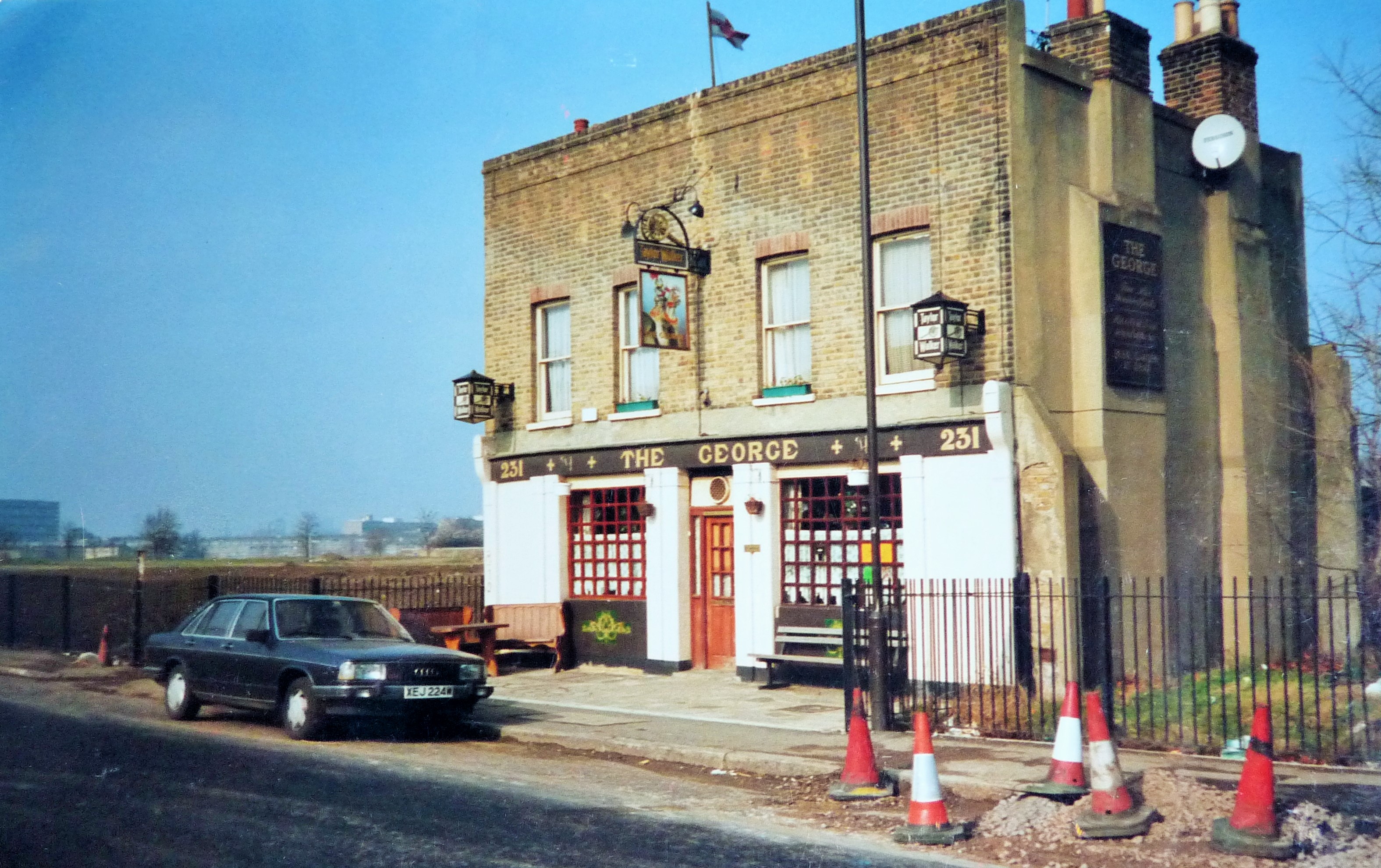
Back in June 1972, The Evening Standard reported that: Unfortunately clearing this 150 acre park involves displacing nearly 6000 people. Some live in tenement blocks and terraces from which they will be glad to escape to council flats. But also due to come down are some rather fine 19th century houses, rare visual delights in the otherwise uninspiring area between the North Peckham redevelopment to the south, and the monumental new Aylesbury estate in Walworth. (The Aylesbury Estate can be seen on the left of the photo below).
As Southwark Council mention on its website: The park grew steadily, taking in hundreds of demolished dwellings, thirty streets, a few factories, churches, and filling in an old canal. It was always intended that the park would have regional importance yet its management and funding over the years have failed to deliver this ambition and although it is an important part of many local people’s lives there is a consensus that the park has never been ‘finished’.
In The Story of Camberwell, Mary Boast points out the fact that Burgess Park is an anomaly. Simply put, the creation of a park from what was once streets packed full of terraces and factories and shops and pubs is a reversal of the normal pattern of events in the capital. Land that was once open fields was given over to market gardens; which in their turn were built over by speculative developments. But now that land has once again become open fields, easily accessible to those living close by.
This came over a century too late for my grandfather’s older siblings, who would possibly have found their recreation along the old Surrey Canal (filled in by the 1970s) during the brief time they lived in the area. The outline of the waterway can still be traced in Burgess Park, with many of the canal’s bridges still intact, creating the strange effect of a lost landscape. Perhaps that is what I found so unsettling about the park on my initial visit – it was if the land was still attempting to redefine itself. However, returning recently on an unseasonably warm March Sunday, when the park was being utilised to full capacity, the sombre feelings that had accompanied me on my earlier visit were dissipated by the sight of so many young families enjoying the (much improved) public space. Did many of the Victorian residents of Kennington also regard their park in a new light once it was in full bloom and memories of the old common had faded away?
One of the most charming aspects of Kennington Park today is the late Victorian, Arts and Crafts tearooms, which were recently refurbished after lying vacant for several years. I stumbled across the Kennington Park Café on a bright spring morning after trekking several miles round the neighbourhood on an empty stomach, and fell upon my generously-filled toastie and mug of builders’ tea like Esau on his pottage. Now, whenever I am exploring the area I detour just to eat here, and if weather permits, sit on the terrace and enjoy the friendly green vibes of the park.

Kennington Park Tearooms today, with the pioneering 60s Brandon Estate (site of Aldred Road) in the background
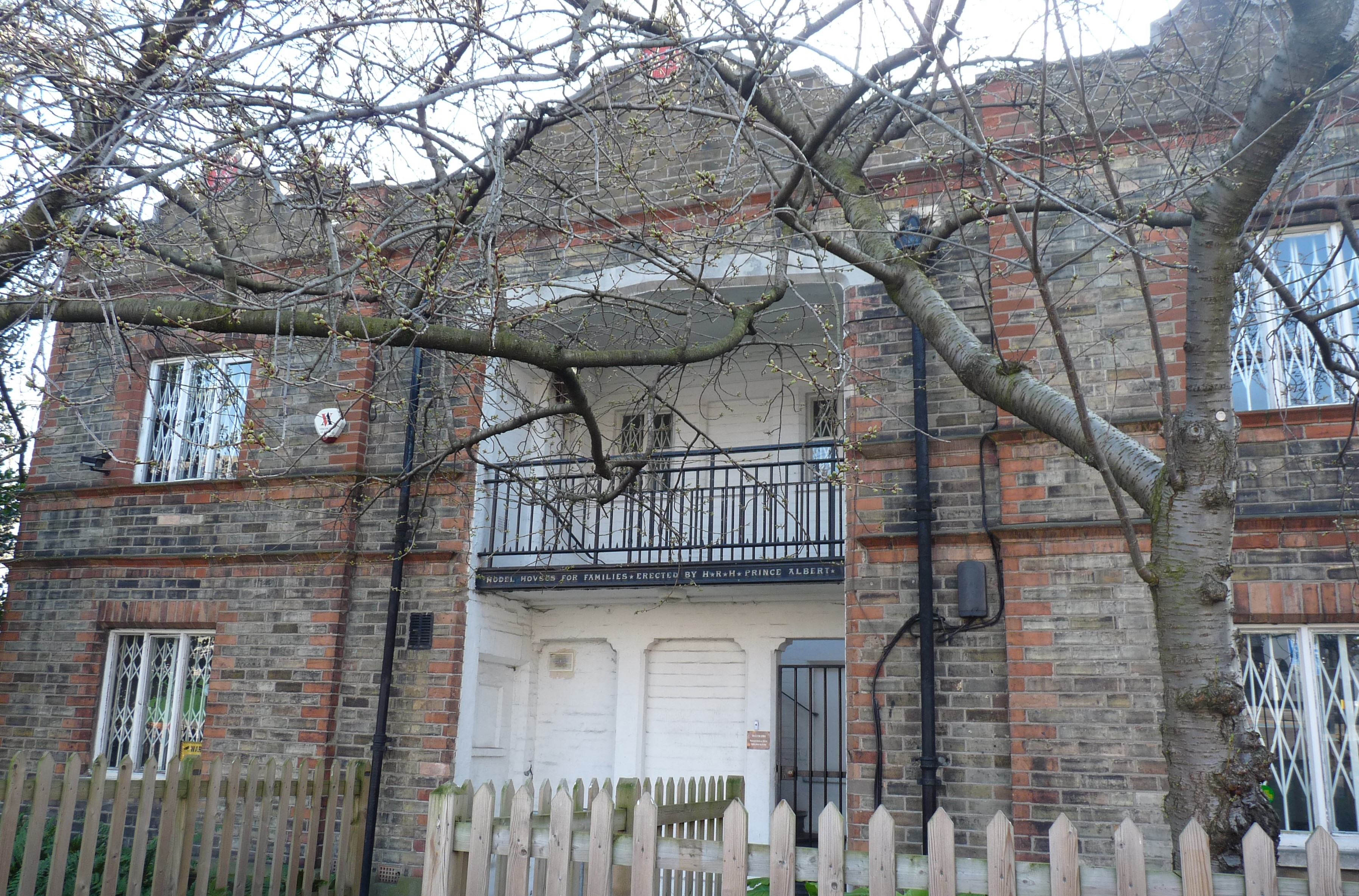
Although the tearooms were built too late for Arthur’s family to enjoy, previously there had been a purpose-built wooden building in the park where visitors could buy food and drinks (from 1861-88). Even further back, when the park first opened, the park keeper’s wife sold refreshments from the rear porch of the Prince Consort Lodge. Now occupied by the national charity Trees for Cities, the Lodge is a semi-detached house which was designed as a showcase for model workers’ dwellings by the Society for the Improving the Condition of the Labouring Classes, of which Prince Albert was president.
Originally built for the Great Exhibition in 1851, the building was later moved to the front gates of Kennington Park, where one of the cottages could be inspected by the public (two park attendants lived in the other cottage). While some believe it was – and still is – an important reminder of the Chartist legacy, others feel that the cottages served more to appease the conscience of the middle classes. In the end, very few houses to this design were actually built for workers in London, and it was to be almost a century later before many of Arthur’s children could live in a house that contained such luxuries as an indoor flushing W.C. (see I Remember, I Remember).
Nearby Burgess Park also boasts its own brand of ‘model housing’ – in this case the old alms houses of the Female Friendly Society Asylum in what is now Chumleigh Gardens. Built in 1821, they suffered bomb damage in WW2, and although incorporated into the park from the outset, were not renovated until 1981. They now house the park offices, community centre and café, and are surrounded by the popular multicultural garden. An interesting heritage trail which takes in these buildings and other historic sites in the park is described on the wittily-named Bridge to Nowhere website, run by the Friends of Burgess Park.

Both parks – Kennington and Burgess – are separated by a century of policy and changing attitudes to public space. Products of history and circumstance, they link one generation of my London family to another, however tenuously. Whenever I am in south London, I am pulled back to them again and again, even if they can no longer offer up any clues to my family’s past.

I go to Kennington Park to wonder at what it would have felt like to stroll the more formal (and no doubt very crowded) mid-Victorian gardens of Arthur senior and his siblings; to Burgess Park to wonder at the lost streets and the filled-in canal, and the densely-packed community that once thrived where now there are fields and gardens and an artificial lake. And every time I visit the two parks, I wonder what my south London ancestors would make of these now very modern, urban spaces.
The Incidental Genealogist, March 2021

Hello!
It’s great fun reading your articles -I enjoy your research very much.
I’ve been researching my Holton relatives in lengthy fits & starts so I’ve just discovered your writing. I must say, I’m getting a great sense of the area S/S.E. of the Thames thanks to you! (And this from Seattle, Washington).
My grandfather was Harry Holton (1883 Balham), son of Mark Holton (1838 Wiltshire) &, I believe, Elizabeth (née ___?). Her last address was Rinaldo Rd in Balham. Mark was born to William Holton & Tabitha (Ford) of Wiltshire. Oral family history says Mark worked at (I understand to mean, “in service”) a large house/estate in the area.
Mark had many siblings, & even more children, so I find myself wondering if I’m your American cousin!
While I’m not gleaning a connection yet from your articles it seems too incidental to have so many Holtons in that area of London not be related somehow.
Cheers & thanks again for sharing your work!
Lori
LikeLiked by 1 person
Hi Lori
Thanks for your very positive comments. They are much appreciated. Lovely to hear about your own research, which has now inspired me to want to find out a bit more about the Holtons – so watch this space! I believe Elizabeth Holton’s paternal grandparents came from the west country as well so there could be a connection. It’s so nice to get feedback from other researchers and one of the positive aspects about writing the blog. I’ll let you know if I find out anything in the meantime, but certainly this is due a post later in the year.
Best wishes
Carolyn
LikeLike